Wednesday, December 29, 2010
This busy stretch of road was in fact named after an historic cave and spring that were destroyed in the name of progress in 1962 when Interstate 70 was developed through Saint Peters, Missouri. Googling this proved futile and it took a lot of research from a variety of obscure sources to uncover this information. For example, I personally dug up these newspaper articles from the archived originals and posted them online.
I have decided to share this because there's really nothing left of it. Aside from some drains and tunnels running underneath the highway, one wouldn't find much of interest here without knowing the history of the spring. Even then, as we learned, the spring has been rendered unrecognizable and therefore, sadly disappointing.
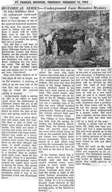
According to the following article, discoveries of Native American artifacts were made and volunteers were invited to help identify and catalog them. It is unknown exactly what all was found.
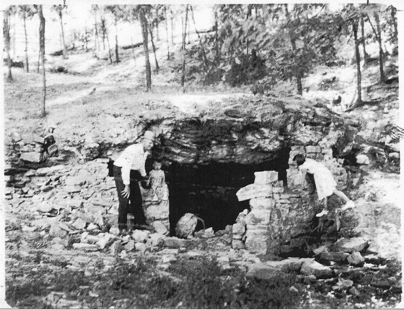
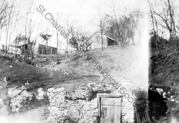
"An underground man-made cave, through which water flows is one of the unsolved historical questions in this area... The first cave is about 30x12 feet and about eight feet high. The floor is of hand cut stone, some pieces being 12x24 inches. The walls are made of varying size stone and the ceiling is covered with large stones... The spring flows on the floor through this room. A small wooden door serves as an entrance.. At the opposite end there is a decided drop to another stone built room about 60 feet in legnth.. It is not known why and by whom this was built... The area was once home of the Osage Indians as Indian artifacts found in the area have been traced to that tribe.."
"In the 'Cosmos', dated July 2 1901, a news story told of the drought year and that the council ordered every water wagon to carry water from Cave Springs to the various farms. Lanterns were used to light the spring at night as the water haulers procession continued almost around the clock.."
"During a recent visit to the farm, Mr. Stile was very gracious and had a stone hatchet that had been plowed up in the field... The cave and the old barn are in the path of progress and will soon disappear. A Highway service road will be built within 12 feet of the home and farm will be divided by the road.."
Begin Historic Photos
End Historic Photos
6-23-09
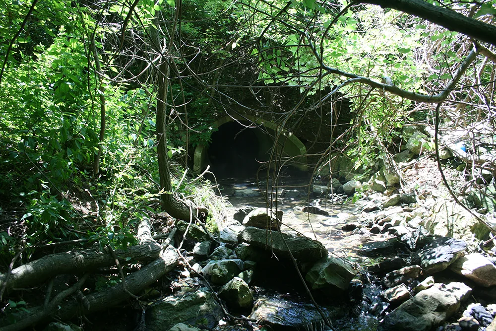
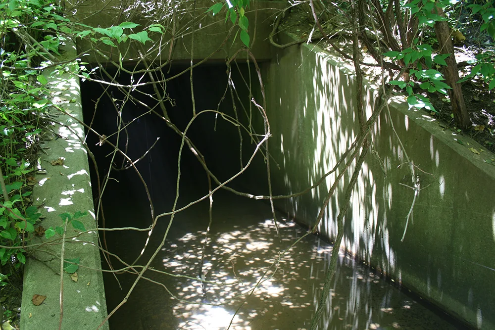
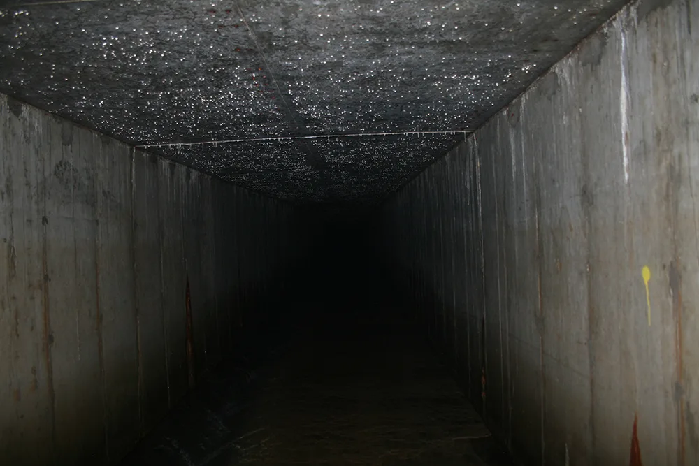
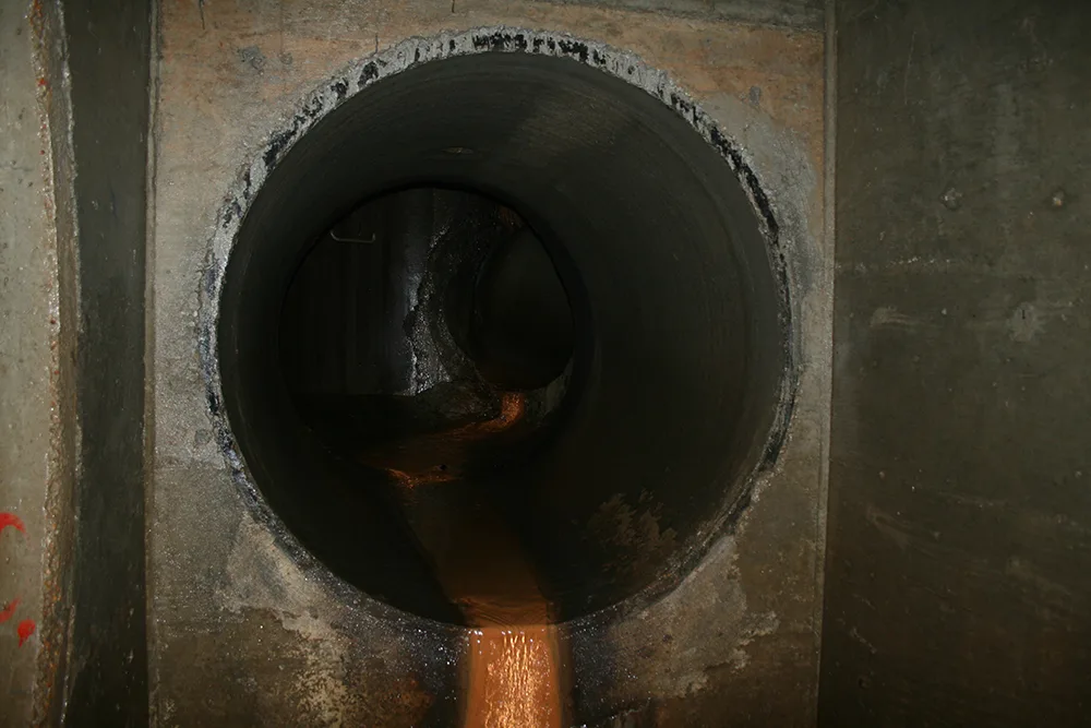
So close yet no cave...on our first visit we entered the outlet and traversed through most of the drains in the area, probably covering about a mile of subterranean passages which all looked about the same:
1-5-2010:
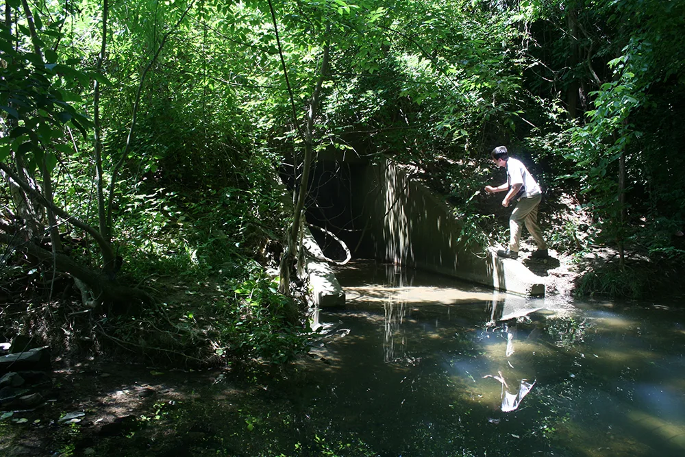
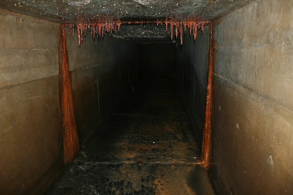
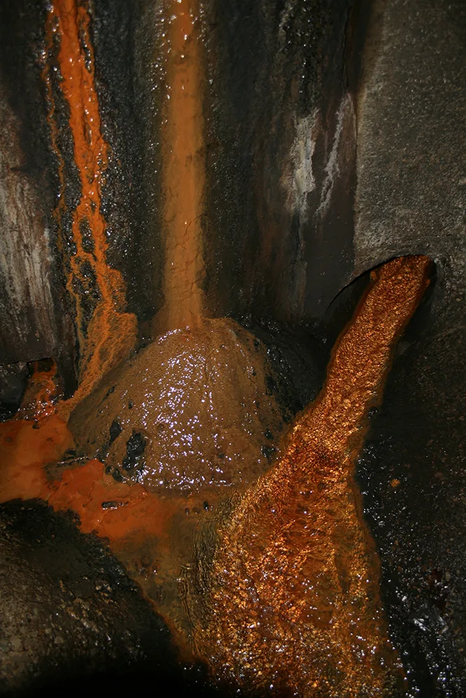
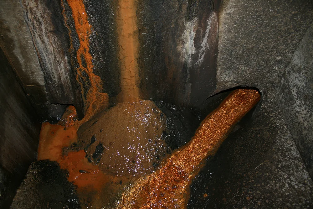
On our previous attempt, we started by entering the outlet and walking or crawling through all the drains in the area, popping up at various spots well outside the target zone, beyond Denny's on the NE end and even further on the opposite side. This time, we entered via a manhole nearer the source and located what's left of it. I do not recommend anyone try to find it because it takes a lot of crawling through small tunnels and there's really nothing to see aside from what I have posted here. Storm drains are pretty boring and all look about the same. The following pictures indicate a combined spring/storm sewer drain which runs below the highway and drains into a creek on the other side.
There was a steady flow of crystal clear water coming from a small tube purpose built and it's evident the designers of this duct accurately calculated the constant flow from its source, evidence that this is in fact the spring and not simply runoff. The bright orange of the clay here indicates also that this is groundwater. We explored the extent of navigable passages on either side of the highway around this intersection and unfortunately, we must conclude that whatever cave that may have been here is no longer.
The only thing left of the cave/spring is, therefore, the water flowing from the top right in the below pictures. The room in which this picture was taken is approximately 10'x5' and the tube with the water flowing out of it is approximately 12". Above ground, a short distance away and in precisely the direction this is coming from, is a filled in sinkhole.
Altogether, this is conclusive evidence of the existence of the historic Cave Springs. Occasionally, street names are but a reminder of their long forgotten namesakes.
11 Comments:
-
- lkench said...
August 1, 2014 at 9:53 PM"occasionally, street names are but a reminder of their long forgotten namesakes"...kinda like Venture Dr or Regency Pkwy?- Unknown said...
September 9, 2016 at 1:07 PMVery interesting. I've been trying to find out where the spring and old cave location is too. From those pics are you entering by venture dr. & mexico rd? or in the valley between cave springs and zumbehl rd? You're right, it's hard to research it.- Unknown said...
September 9, 2016 at 1:08 PMThis is very interesting. Is the outlet tunnel next to St.Johns bank or further east between cave springs and zumbehl?- STLOUISX50 said...
October 1, 2016 at 10:06 PMVery interesting. I lived in St. Charles County most of my life and I heard there was no cave or spring. It's nice to see research was done and in face there was indeed both. Thanks for the research and photos.- Gordon said...
May 23, 2017 at 9:02 AMThanks! I've wondered about this for a very long time.- Unknown said...
October 10, 2017 at 12:56 PMThis belongs on Wikipedia. Do you know how many times since the internet was invented by Al Gore that I've tried to find why the area was called Cave Springs?- Unknown said...
January 16, 2019 at 4:25 PMNice! Keep up the great work. It would be nice if people read your warnings and didn't ask where it is.- Becki DeGraffenreid said...
December 14, 2023 at 9:07 PMMy ancestors are from just northeast of Springfield. There is an old family story of a cave there where one of them hid out during the Civil War, though he died not long after from the effects of the atmosphere of staying in the cave so long. Perhaps this cave was also used as protection during the war.- Gary said...
March 13, 2024 at 12:05 AMI felt that awesome feeling of nostalgia reading this. Thank you 4 that- Anonymous said...
April 5, 2024 at 8:48 PMWe live between 70 and Muegge Road. There is a creek behind our house that has a spring at one bend of the creek. Our home was built on the old Ralph Haake Farm that was off of Country Club Road.- BB said...
April 11, 2024 at 6:45 PMI don't understand how anyone planning the city or the highway would think that bulldozing Native Artifacts and turning a spring into a storm water drain. Some day probably soon when the SHTF people will be climbing in there to get water to survive

