Wednesday, August 2, 2017
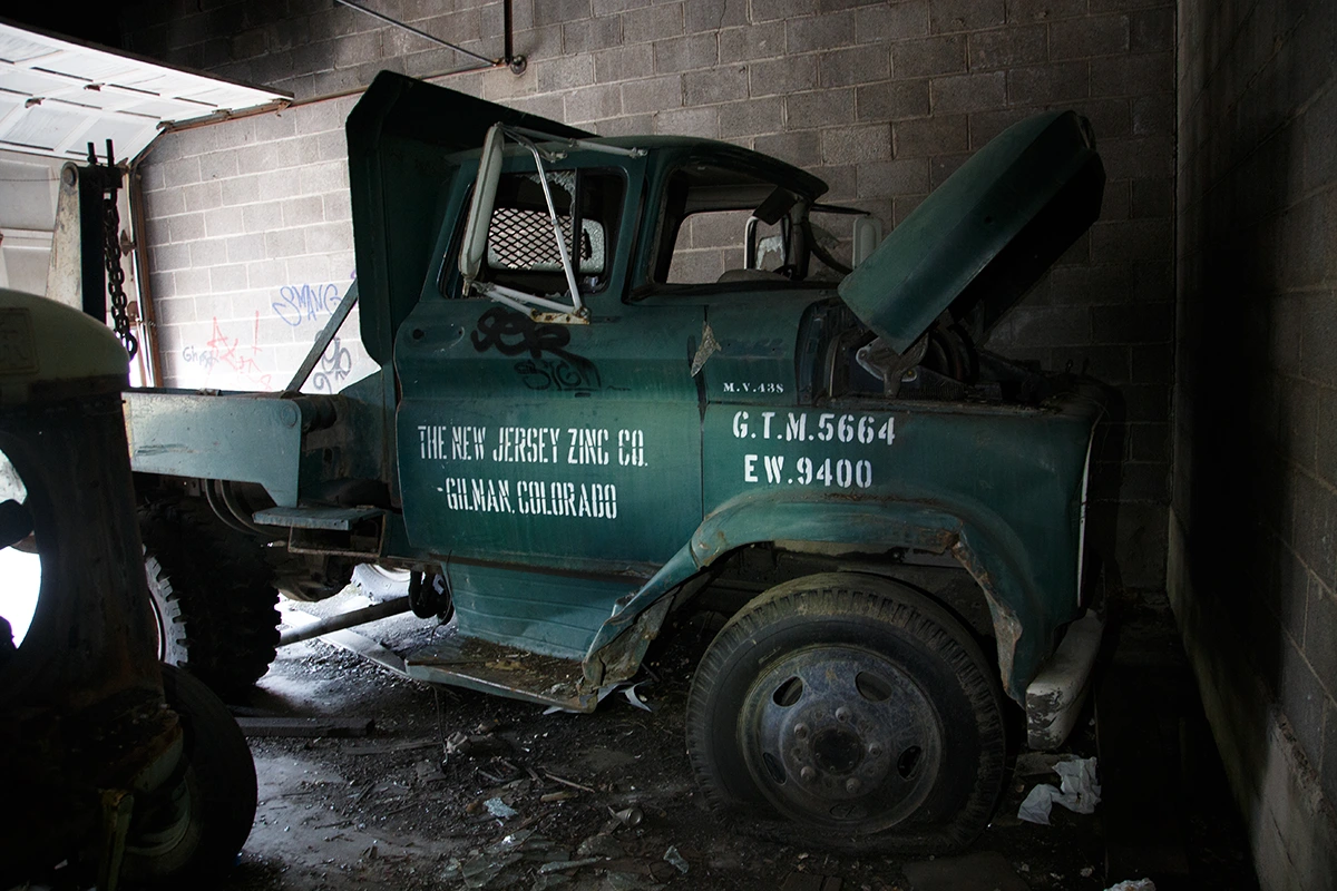
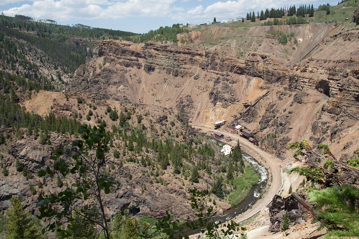
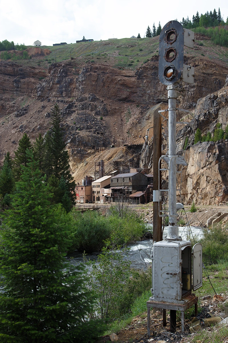
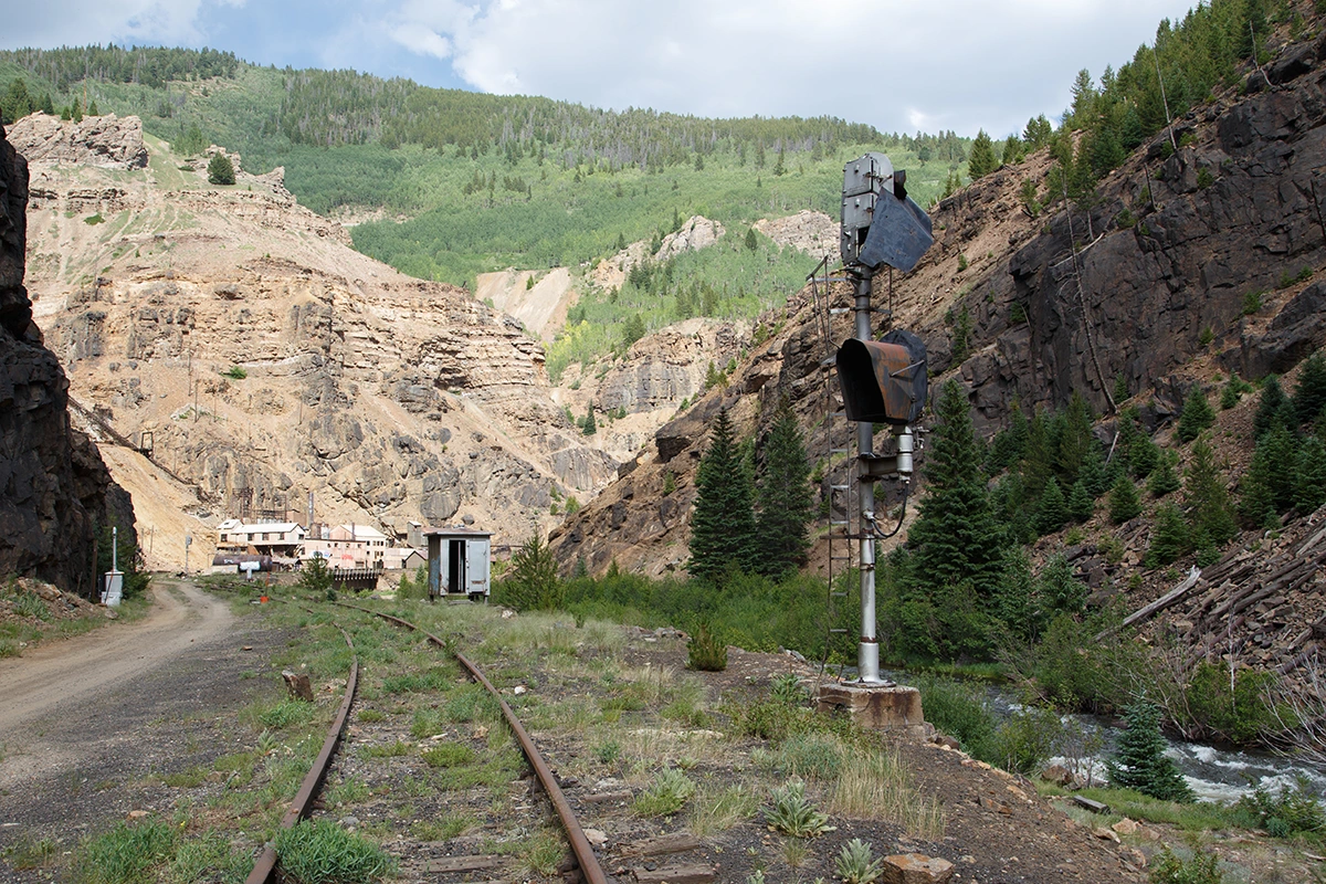
The town of Gilman Colorado was founded in 1886 during the "Colorado Silver Boom". It is situated at the top of a 600ft cliff, at the base of which lies the Eagle Mine. Eagle Mine was a silver mine originally but high concentrations of other metals such as Lead and Zinc were found to such an extent that they expanded their operations in order to capitalize on these unexpected assets. In the late 1870's, several mines had been constructed on the cliffs along Eagle River. Notable among them were such mines as Iron Mask and Ground Hog. In the 1880's, a judge and prospector from the nearby town of Red Cliff named John Clinton acquired several of these mines. Clinton developed the town in order to provide housing for the miners working there. Gilman eventually had its own theater, bowling alley, infirmary and even newspaper in addition to the school and numerous workshops.
In 1882, the Denver and Rio Grande railroad reached the mining camp at the base of the cliffs. In 1899, Gilman had a population of about 300 and by the 1930s, Eagle Mine was the largest producer of Silver in Colorado. In 1912, the New Jersey Zinc Company began buying up portions of the site before eventually controlling all of it for the next roughly 70 years. "By 1970, total production at the mines was 10 million tons of ore; 393,000 troy ounces (12,200 kg) of gold; 66,000,000 troy ounces (2,100,000 kg) of silver; 105,000 tons of copper; 148,000 tons of lead; and 858,000 tons of zinc."-Wikipedia.
In 1984, New Jersey Zinc decided to close Eagle mine due to unprofitably low zinc prices. The mine subsequently flooded which contaminated the groundwater and caused the EPA to step in and order the residents of Gilman to evacuate.
In 2017, I had the opportunity to go on a road trip through the mountains with my wife. Naturally Gilman made it on my list. But our expedition here got off to a rough start.. My main interest here was the mine itself and, if I had time, the town above it. My mistake was that I mis-judged the cliffs separating the two and the risks they presented. There appeared to be some paths across them with which one might be able to navigate downward from Highway 24 above. It appeared to be possible to take the tree-line down even if the paths ended. We walked back and forth along them for what seemed like hours. We'd regularly stop to look over the edges in hopes of seeing a trail downward. Each time we scooted as far as possible while knocking rocks and debris loose under our feet and listened to the sounds they made as they fell. During this process we passed several of the old and much harder to reach mine tunnels hidden along the way. It appeared all too easy to fall to our deaths or serious injury from up here and I didn't really want to find out just how easy it would be. In my defense I almost always seek out different methods of access to locations. In most cases it's to be more discreet. In this case I wanted to avoid having to hike further than necessary. That plan gloriously backfired. I could omit the details but I figure I might as well document my stupidity for your entertainment and also to provide insight into how dangerous exploring Colorado can be.
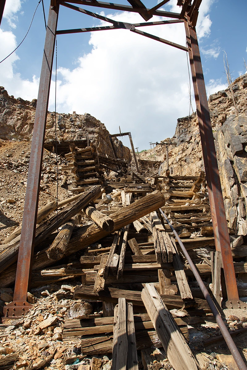
After scouring the hillside we found enough trees on which to bounce from and balance on as we made our descent. But that didn't really make things much easier, especially as we got to the bottom. The tree line gives way to loose boulders and, further down, sheer rock faces. Roughly 30 feet from the road below, it became obvious that the descent would be increasingly vertical. It was becoming extremely dangerous and more difficult to navigate the closer to the bottom we got. We had no climbing gear and we were almost out of water. But going back up at this point wasn't really a good option. It was clear that we were tempting an avalanche as we proceeded further down. If I had truly felt that I wasn't sure we could make it at any point, I would have retreated back up. But as we went, I was able to stay low and grab onto nearby branches to retain control. So, as carefully as possible, we navigated the stupidly dangerous rocks and finally made it down to the access road. It was now 2:30pm, my feet were bloodied and blistered and my legs were unsteady. And of course, the car was now on the wrong end of the cliff. I had originally planned to use the crumbling rail trestle back up the other side, but at this point neither of us were willing to risk it. I don't claim to be a smart person but this was easily among the stupidest things I've ever done. I was deliriously exhausted by the time we made it down here but extremely grateful for the fact that we made it without serious injury.
Click here for the video.
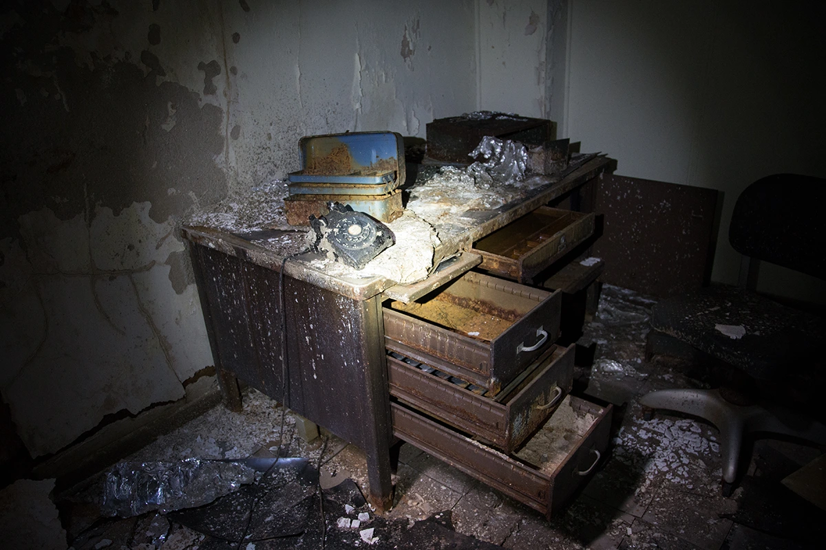
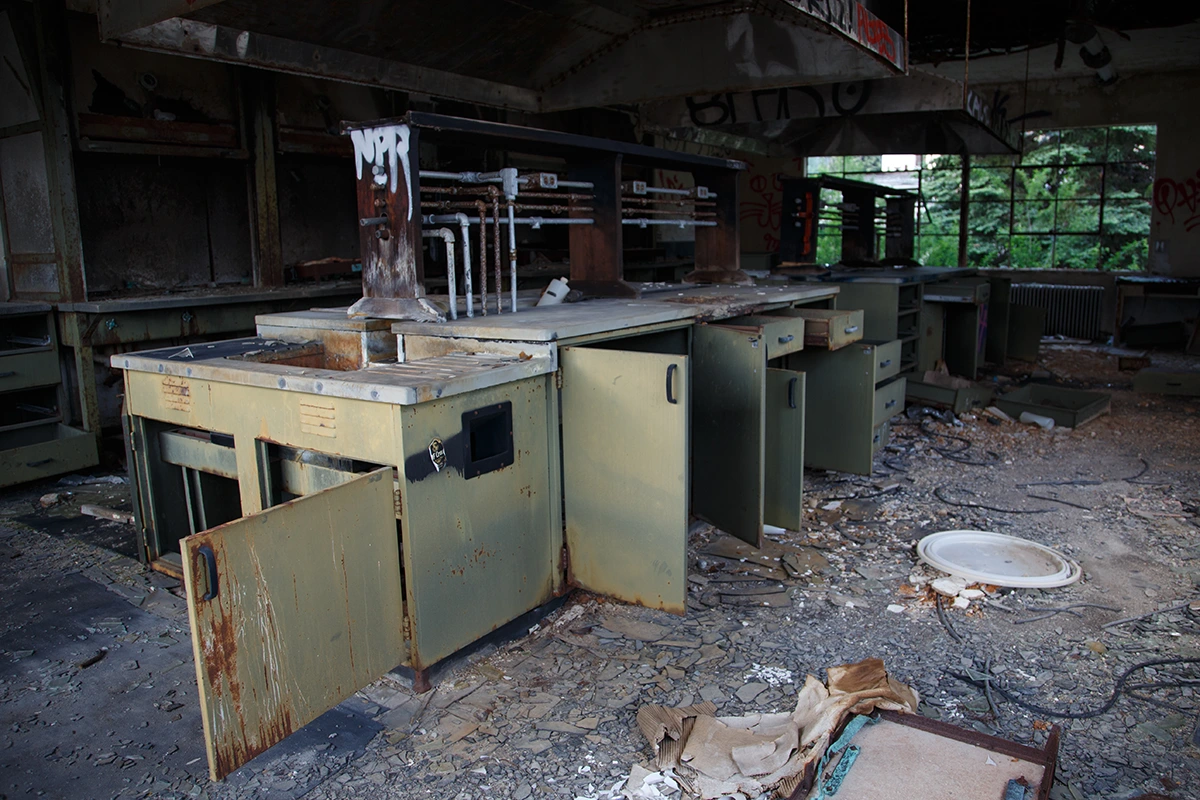
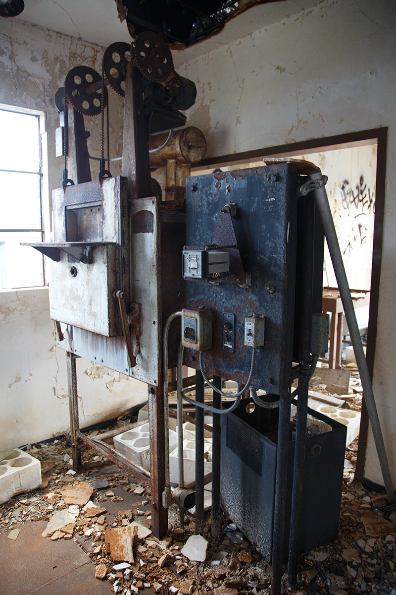
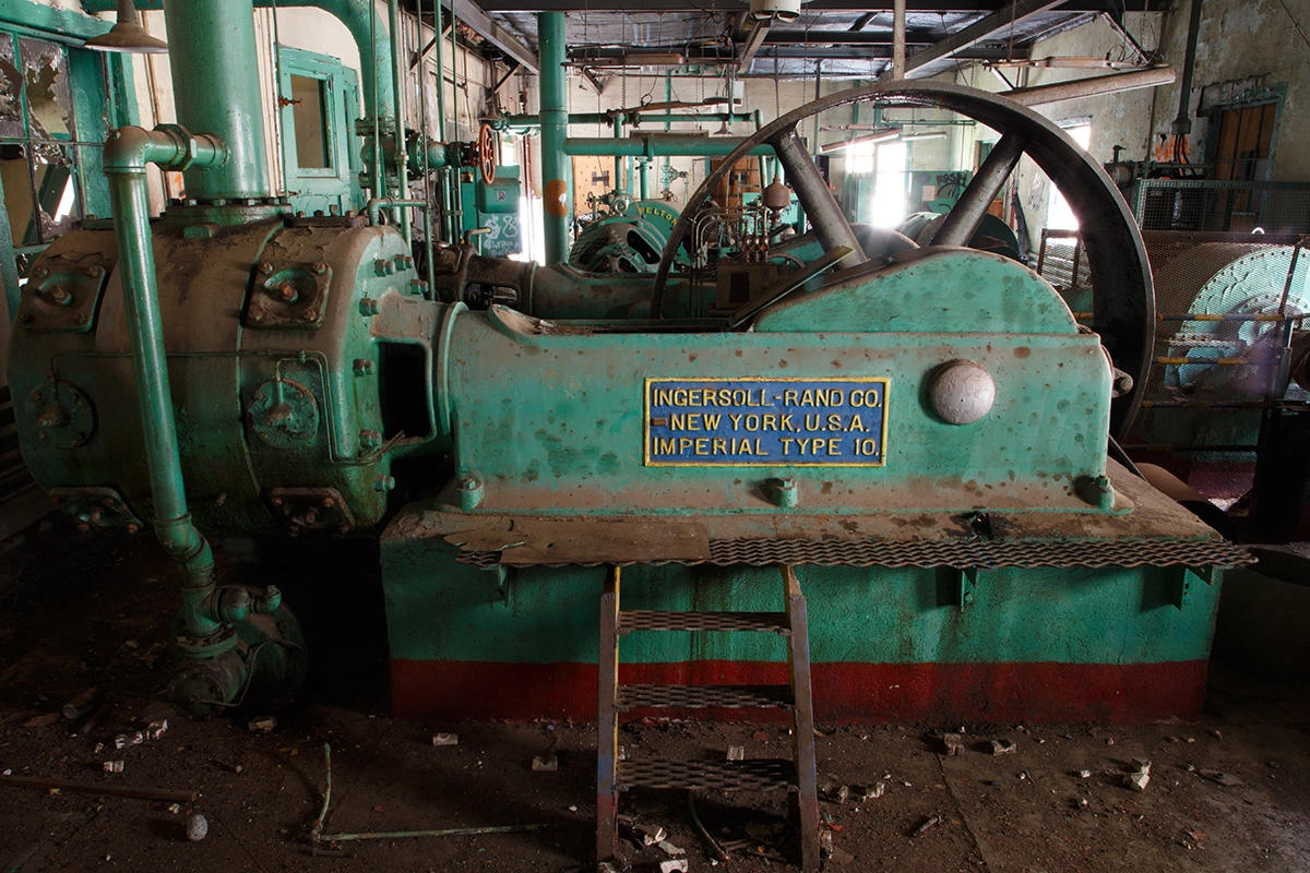
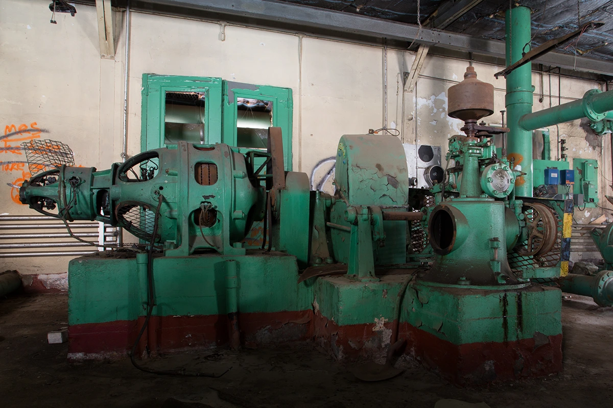
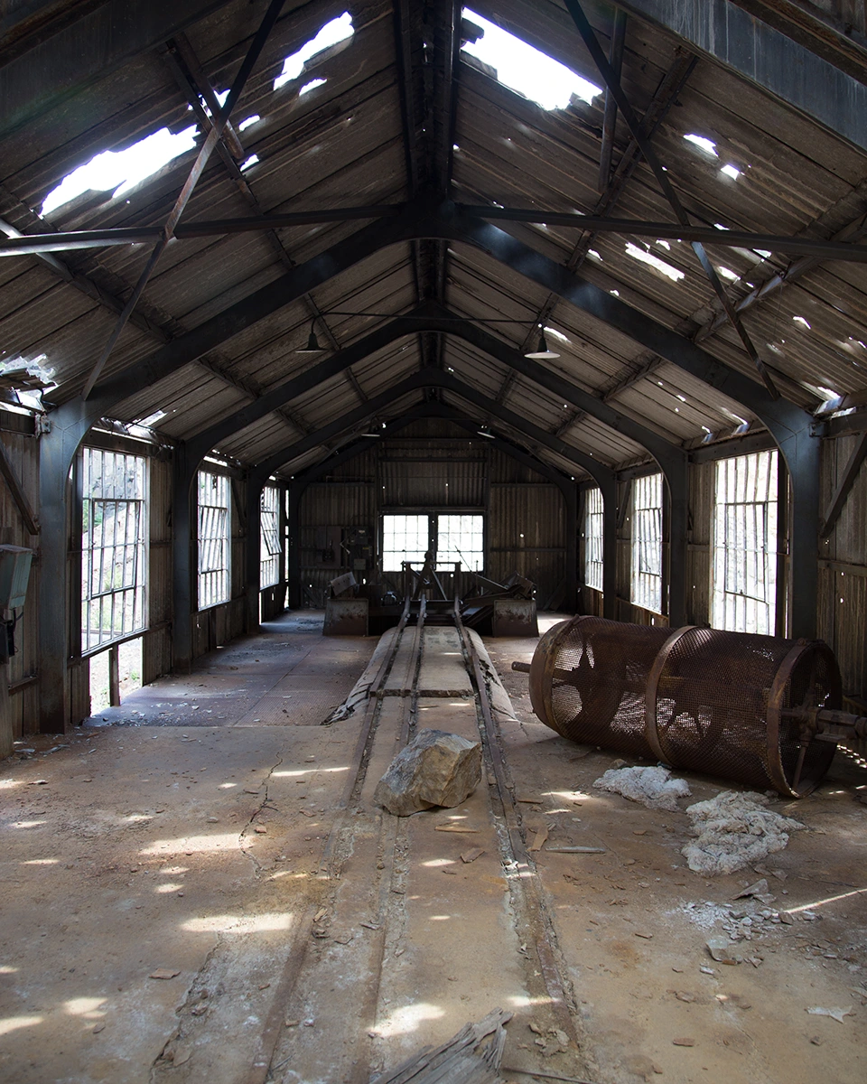
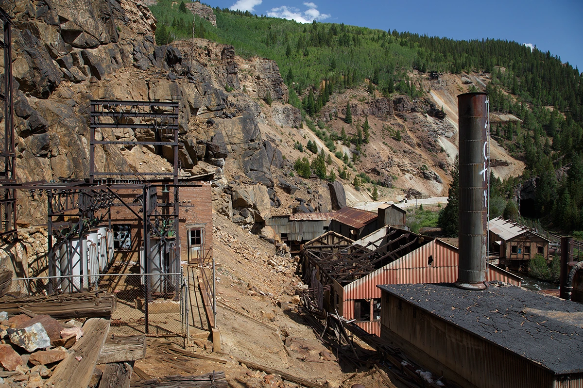
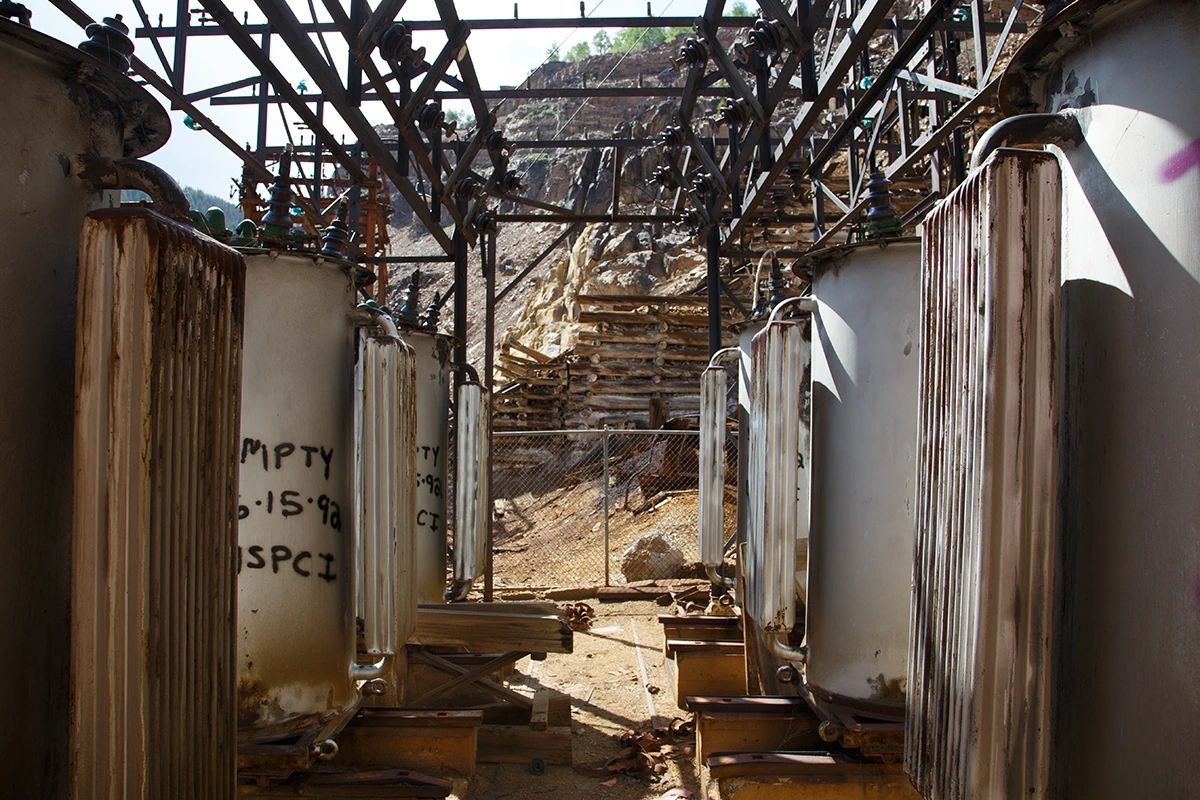
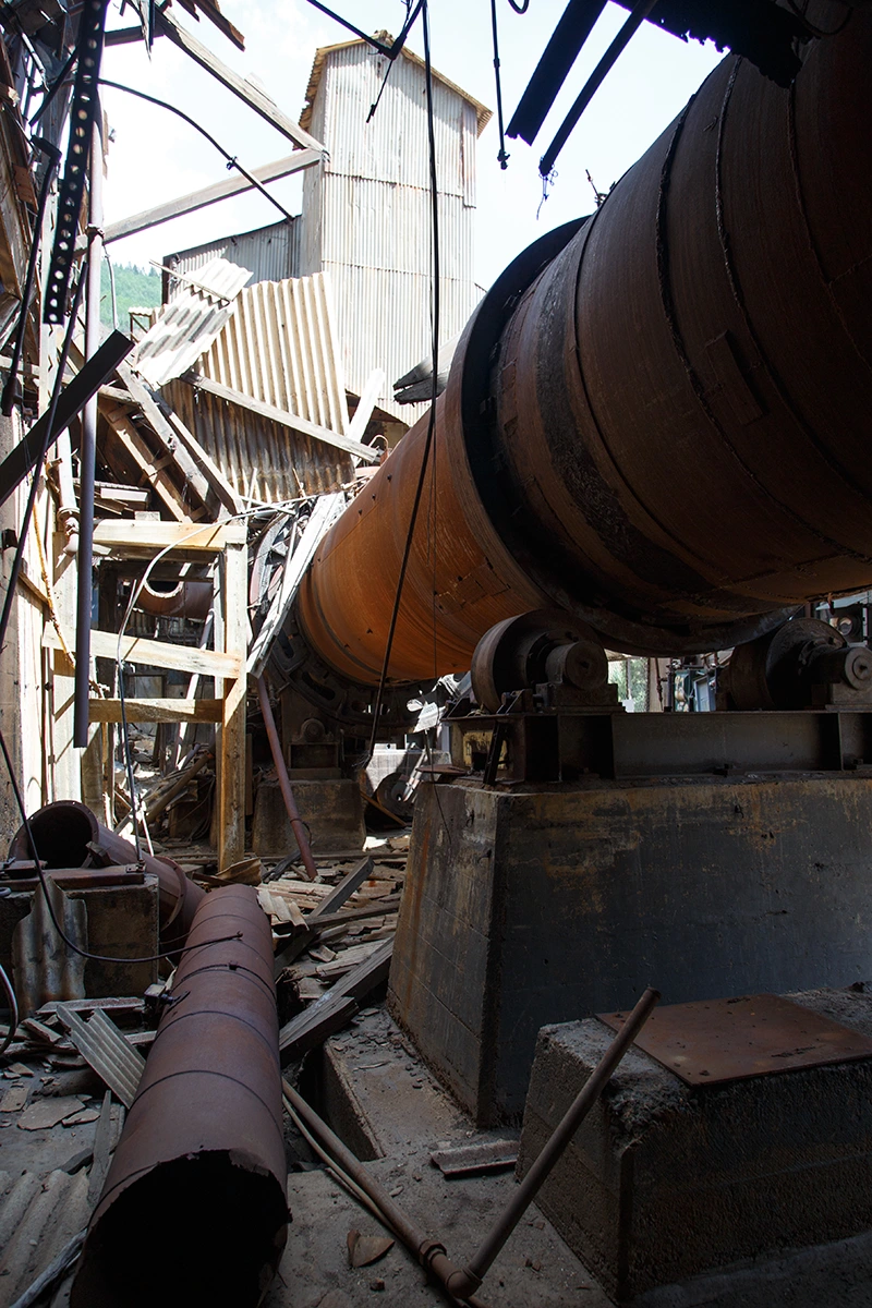
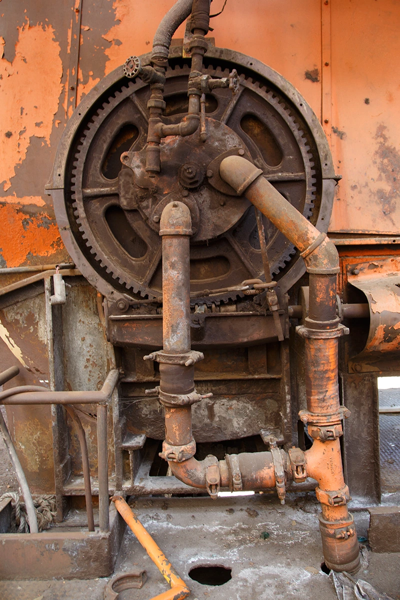
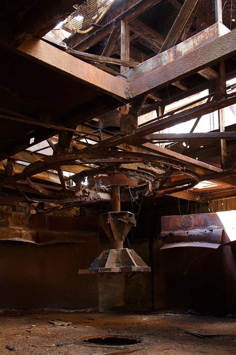
Eagle Mine:
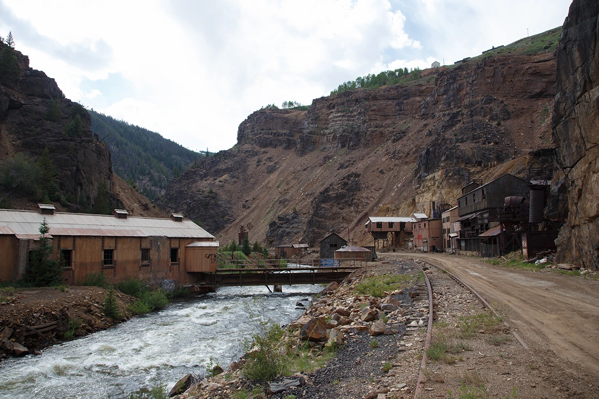
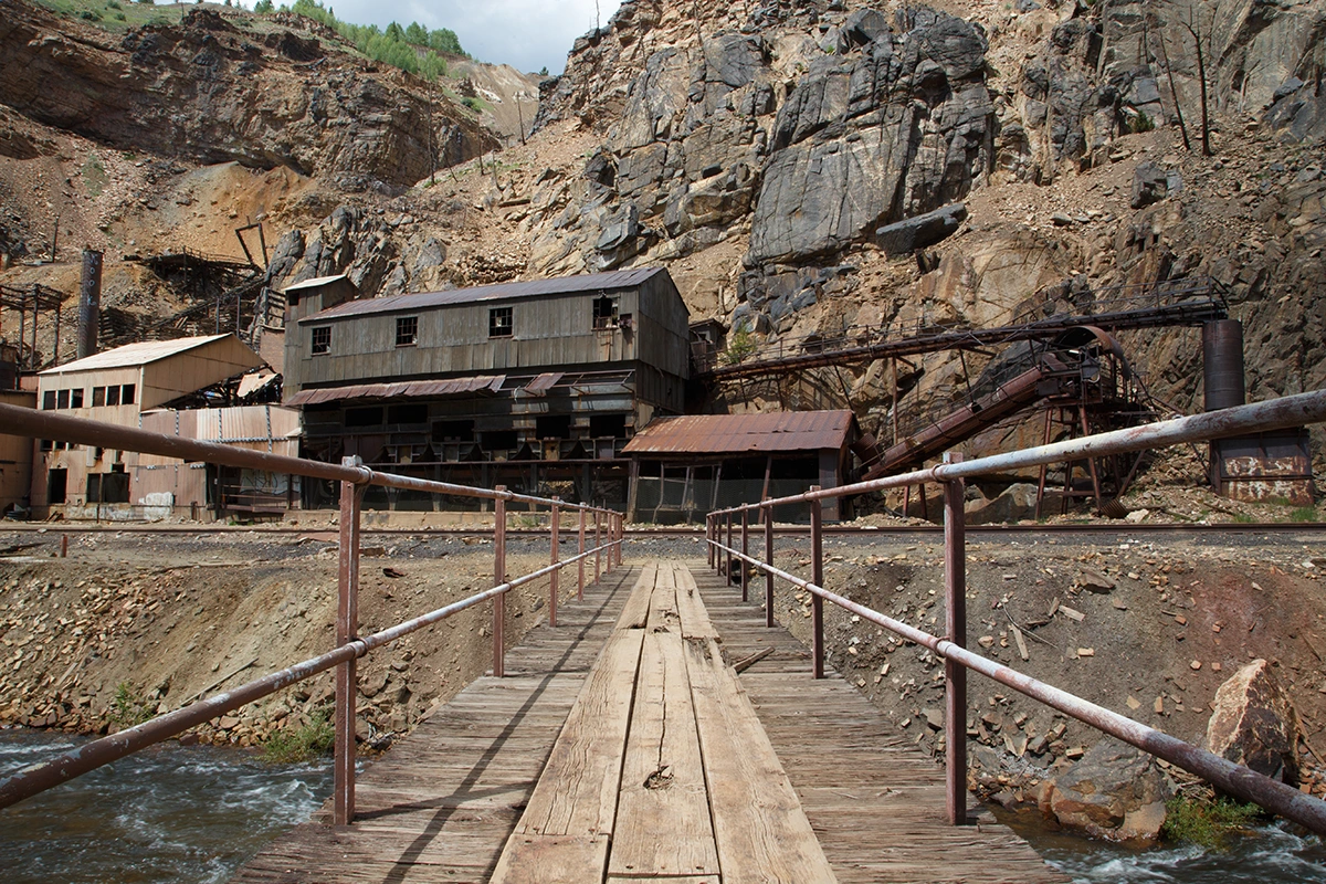
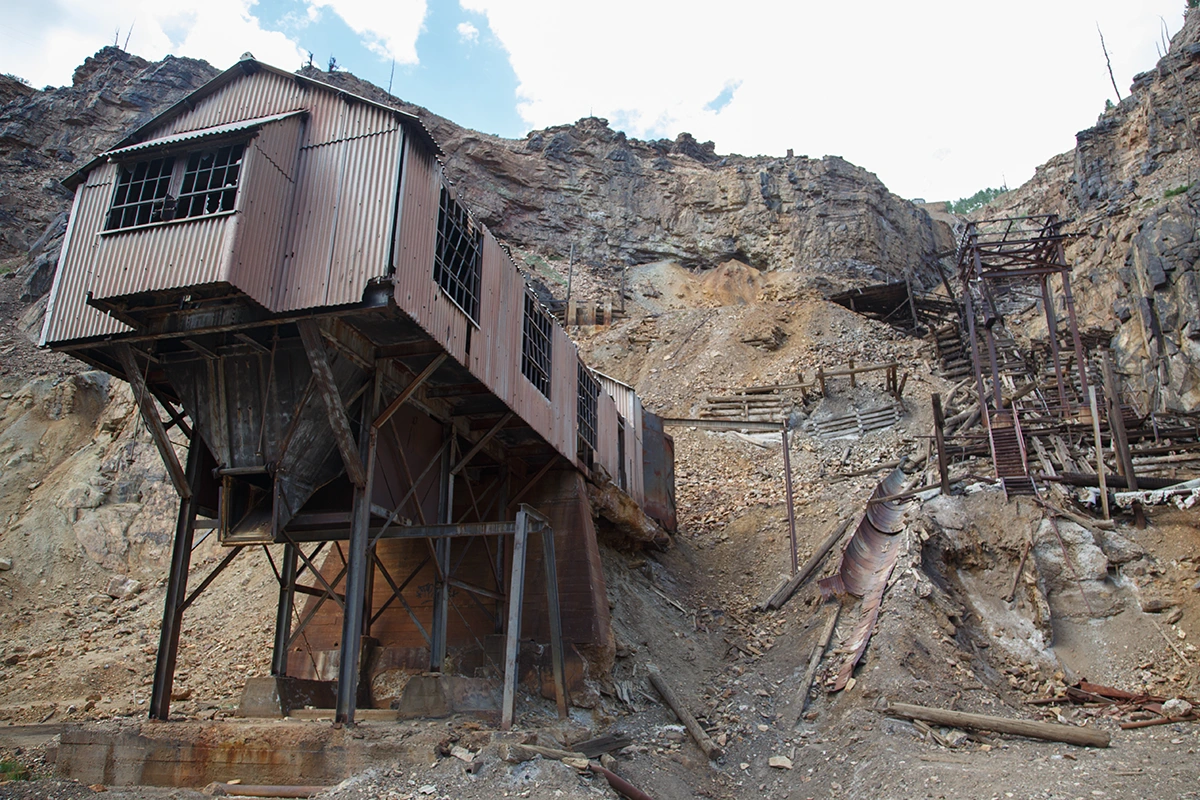
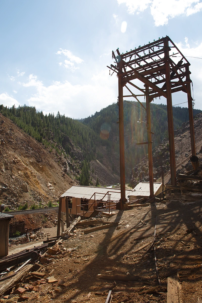
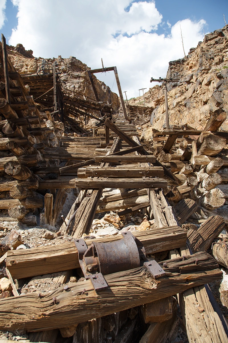
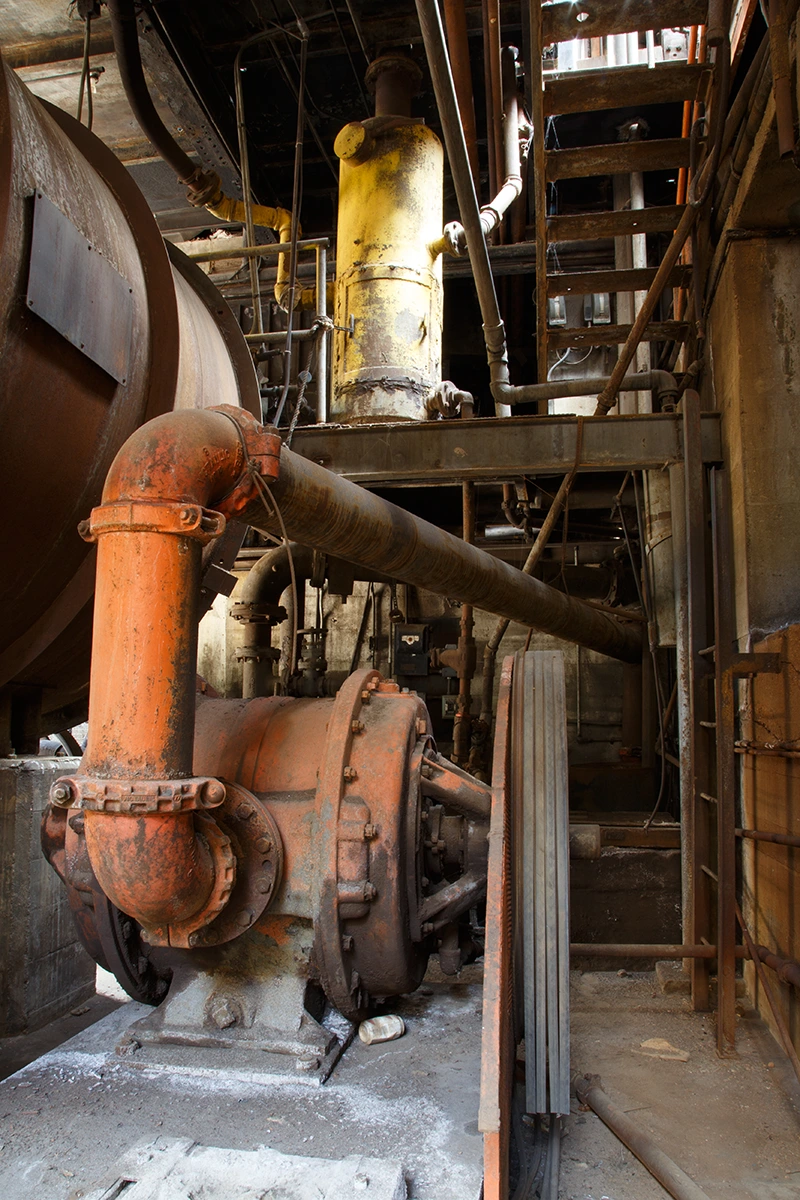
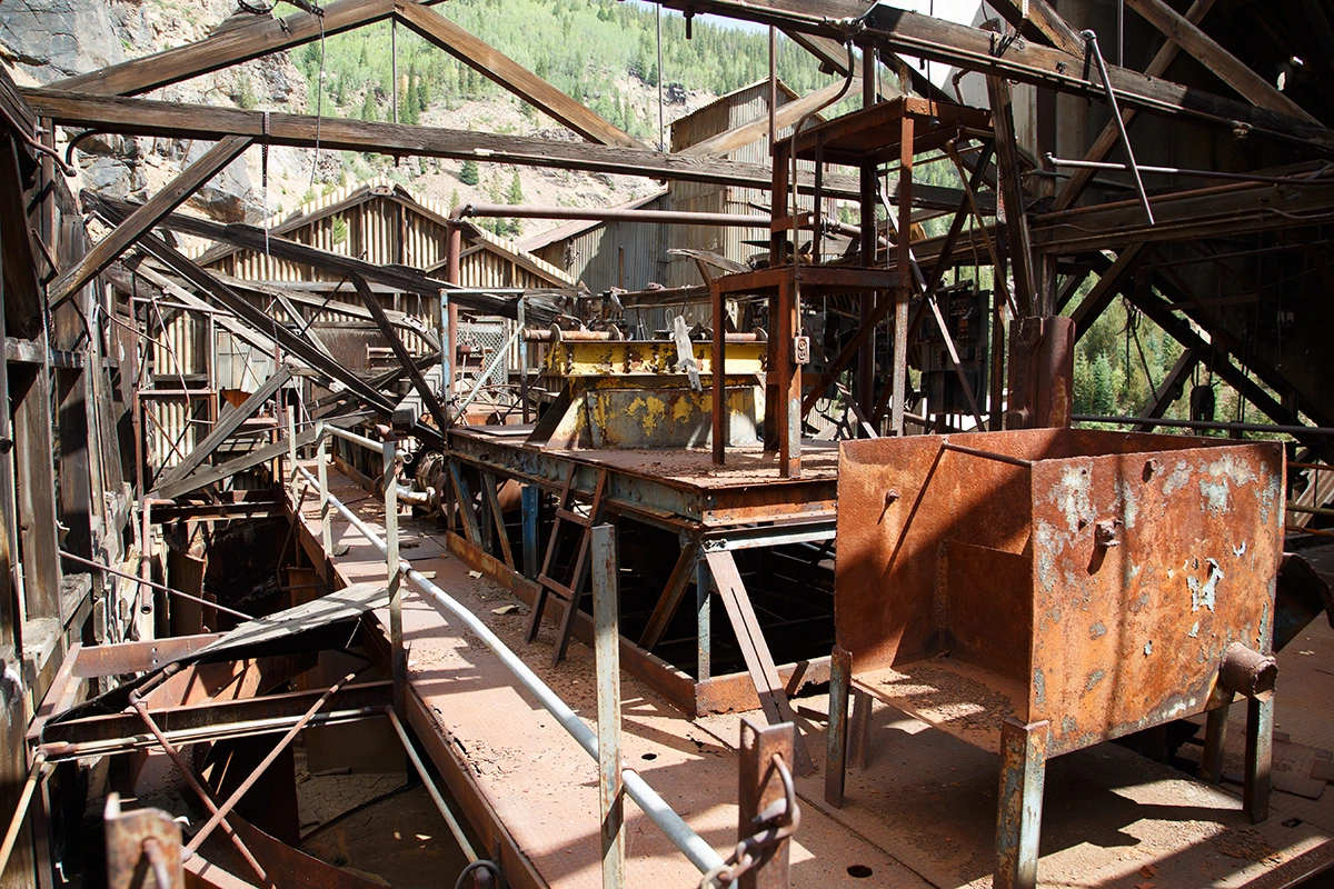
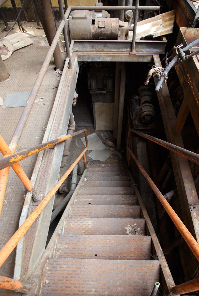
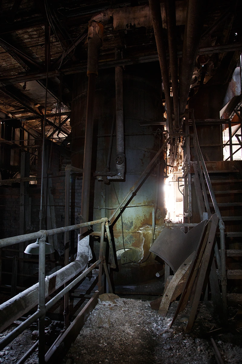
Having succeeded in making it down to Eagle Mine, which was the main objective here as far as I was concerned (there was still more I wanted to see here, but due to exhaustion and lack of water I decided to not push my luck further than we already had..) we now had to hike the ~3.5 miles back to Red Cliff.. and then we had another ~3.5 miles back UP to the car parked near Gilman. Those distances aren't so bad when your feet aren't throbbing and bloody, your mouth isn't dried out and the sun has not been beating you down for most of the day already. But at least it would be stable, solid ground. Along the hike, we encountered several wrecked cars at the base of the cliff and more than one memorial to the various deceased. These tactile reminders of the lethality of the same cliffs I had not adequately respected prior to making our descent were more pronounced after having tempted them myself earlier.
Red Cliff is a quiet mountain town situated in an idyllic valley far away from just about everywhere. It features a General Store with a fully stocked cooler which is home to a kaleidoscope of exquisitely colored labels which God's own robots must have designed and attached to bottles containing the greatest flavors of water and other liquids that have ever been formulated. Or so I imagined. But it was getting late and I wasn't sure if we'd make it before they closed. We crawled into town ragged and desperate. It was dead quiet. Except for a few kids who rode their bikes in the street and their barking dog there was no traffic or sound to be heard. It felt very much like a scene out of a western film as we strangers strode into town while the locals eyed up the new troublemakers with supicion and contempt. The gods had decided not only to spare my life on this quest a from stupid and avoidable death but, to our great fortune, they also decided to convince the owners to hold extended business hours at the General Store. After replenishing our supplies we finally made the last grueling hike back up to the car. And just for one final series of ego crushing insults, this leg of the cursed trip was uphill the entire way and due to the lack of shoulders on the road practically required us to straddle the guard rails on the edge of the cliff along the narrow and winding mountain road-all while the sun was sinking lower and speeding vehicles zipped past uncomfortably fast and close. Tires squealed on more than one occasion and I was sure that none of the drivers expected us to be there. This entire ordeal was positively brutal and completely avoidable.
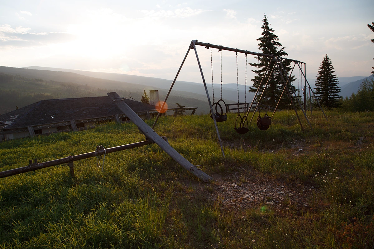
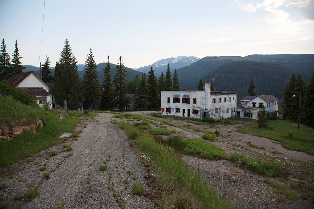
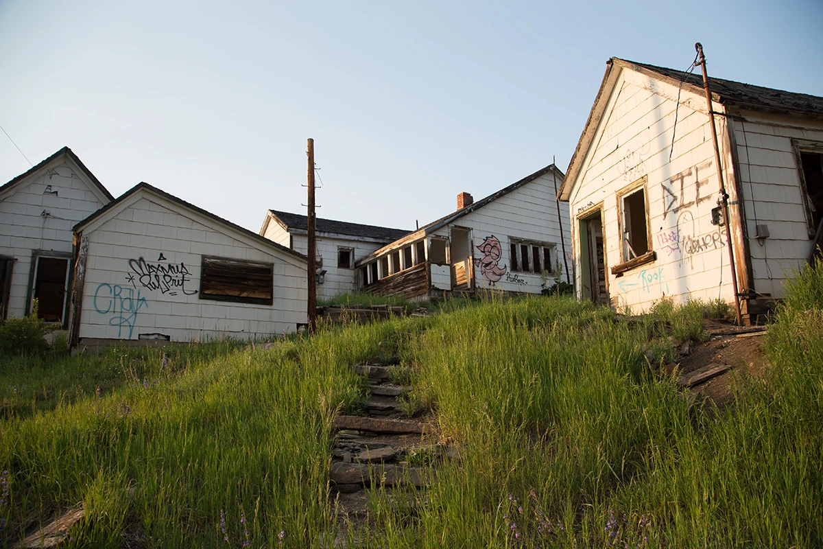
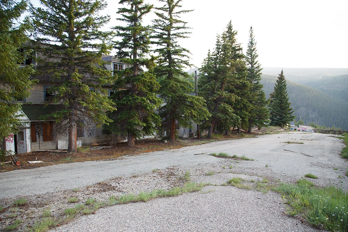
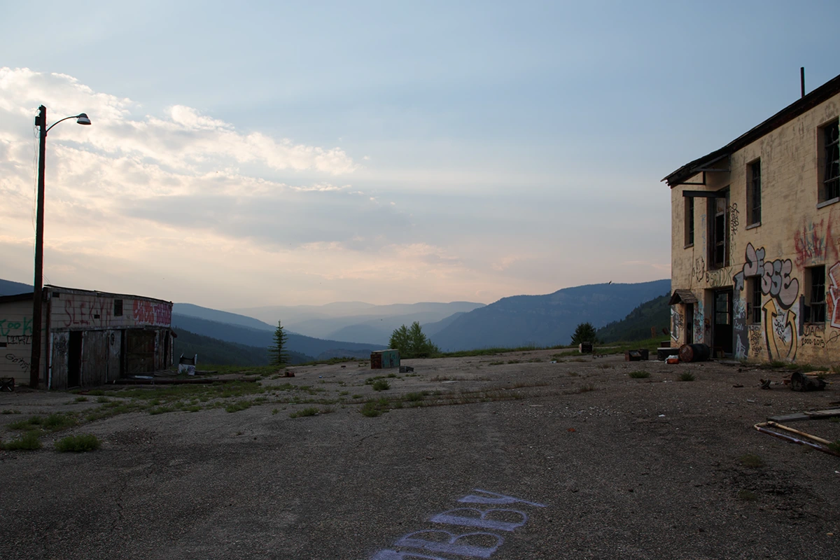
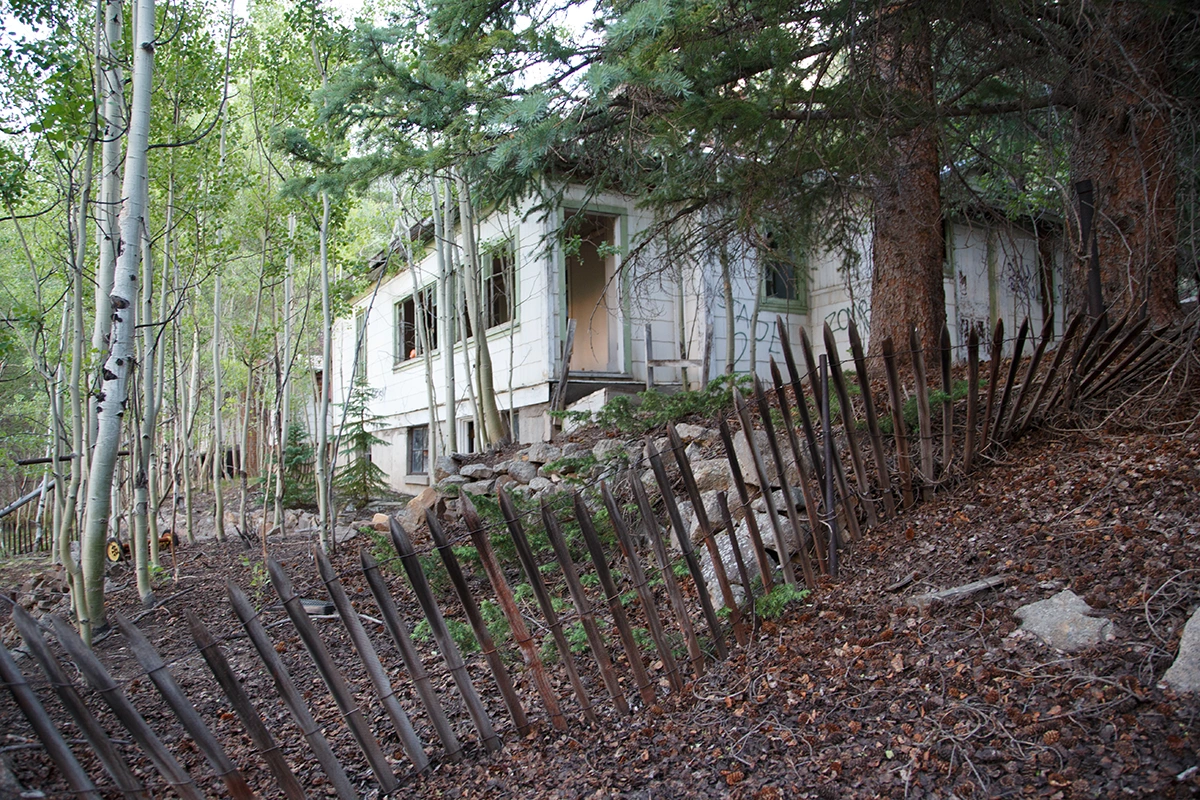
Gilman Colorado
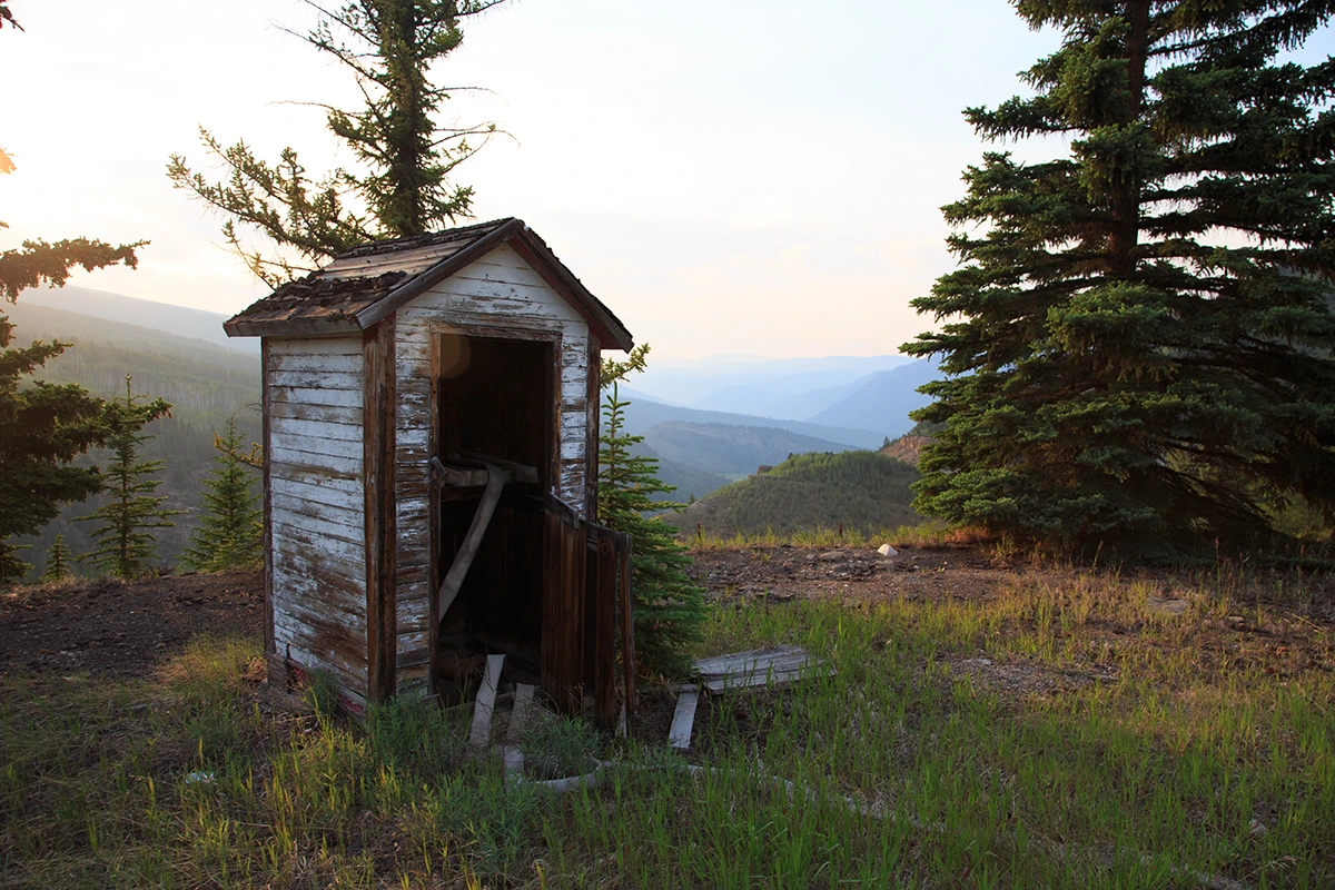
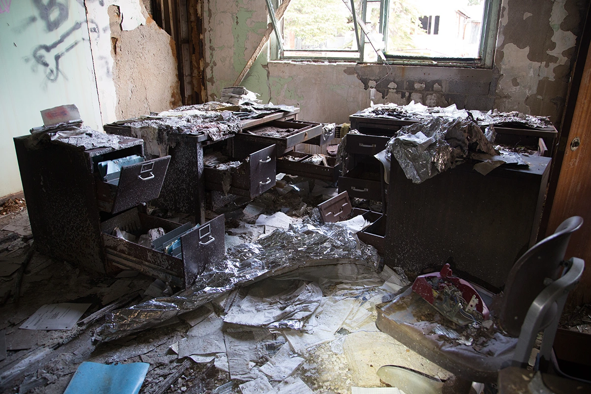
We did eventually make it back to the vehicle without dying, which came as a surprise to both of us. Neither myself nor my wife even remotely wanted to explore the actual town of Gilman at this point. But I did anyway. I already knew there was a lot of destruction here due to the comparatively easy access which the most supremely untalented vandals always seem to thrive on and so the town itself wasn't very high on my priority list. Unsurprisingly, the place was indeed trashed. The resulting scenery was an interesting juxtaposition at least, as it is framed in by the insanely beautiful mountain scenery. It was about 8pm now, my feet were bleeding, I was exhausted and the fading sunlight cast an orange hue across the mountains, the rooftops and some shitty adolescent paint scribblings which now cover the old mining town of Gilman Colorado. I deeply inhaled the mountain air, grateful for life and for being in this place. Man, I love this stuff. I actually hated it. But it was also totally awesome. And horrible.